|
|
 GLACIORISK EUROPEAN PROJECT
|
|
France (CEMAGREF,
ETNA,
ONF-RTM,
LGGE-CNRS), Italy (CNR-IRPI,
SMS/Nimbus), Norway (UOSLO,
NVE),
Iceland (UI
(IS)), Austria (DGGS),
Switzerland (VAW-ETHZ) |
|
WELCOME TO GRIDABASE, GLACIER RISKS DATA BASE :
MAIN MENU
Gridabase
was implemented by
SMS/Nimbus
|
|
|
|
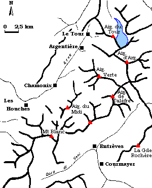
GLACIER "TRIENT"
Risk type: glacier flood (contain both lakes and water pocket)
Glacier list |
Statistics
|
| Type: |
Cirque glacier |
| Country: |
France |
| Region: |
Haute Savoie |
| Massif/Ice Cap: |
Mont Blanc |
| Municipality: |
|
| Municipality code: |
|
| Location: |
|
|
|
| Latitude (°, cent): |
46 |
|
| Longitude (°, cent): |
7 |
| Surface (km2): |
7 |
| Lenght (km): |
5 |
| Width (km): |
0,7 |
| Min. altitude (m): |
1730 |
| Max. altitude (m): |
3500 |
| Orientation (°) |
|
| Slope (°) |
19 |
|
|
EVENT: Date
6/8/1960
- Date quality: |
 |
| Type: |
Glacier flood (contain both lakes and water pocket) |
|
|
| Description |
An increase of water debit torrent " Tine" (25 m3/s). |
|
Effects: |
|
| Deaths(#) |
|
|
|
|
Injuried (#) |
|
| Note |
|
|
DAMAGES |
|
| Type: |
Roads |
Description: |
|
|
BIBLIOGRAPHY |
|
|
Vivian R., 1975 - Les glaciers des Alpes occidentales. Thèse d'état, Imprimerie Allier, Grenoble p.349 (d'après la revue du CAS, C. Mallasigné |
|
|
|
EVENT: Date
7/7/1942
- Date quality: |
|
| Type: |
Glacier flood (contain both lakes and water pocket) |
|
|
| Description |
An increase of water debit torrent (from 3.5 m3/s to 26 m3/s). The volume estimated is about 840 000 m3. |
|
Effects: |
|
| Deaths(#) |
|
|
|
|
Injuried (#) |
|
| Note |
|
|
DAMAGES |
|
| Type: |
Farmland, fertile land |
Description: |
|
|
BIBLIOGRAPHY |
|
|
Vivian R., 1975 - Les glaciers des Alpes occidentales. Thèse d'état, Imprimerie Allier, Grenoble p.349 (d'après la revue du CAS, C. Mallasigné (1969) et la Gazette de Lausanne. |
|
|