|
|
 GLACIORISK EUROPEAN PROJECT
|
|
France (CEMAGREF,
ETNA,
ONF-RTM,
LGGE-CNRS), Italy (CNR-IRPI,
SMS/Nimbus), Norway (UOSLO,
NVE),
Iceland (UI
(IS)), Austria (DGGS),
Switzerland (VAW-ETHZ) |
|
WELCOME TO GRIDABASE, GLACIER RISKS DATA BASE :
MAIN MENU
Gridabase
was implemented by
SMS/Nimbus
|
|
|
|
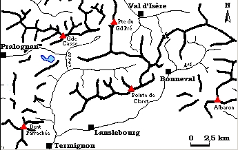
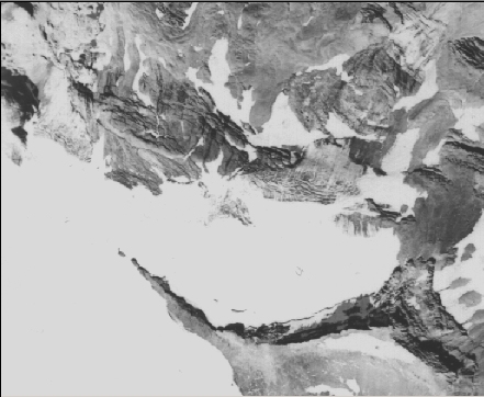
GLACIER "RÉCHASSE"
Risk type: glacier flood (contain both lakes and water pocket)
Glacier list |
Statistics
|
| Type: |
Hanging glacier |
| Country: |
France |
| Region: |
Savoie |
| Massif/Ice Cap: |
Vanoise |
| Municipality: |
Pralognan |
| Municipality code: |
|
| Location: |
Glacier goes down from the Pointe of the Réchasse and from the Glacier Arcellin to the valley of the Vanoise. Northern lobe of the icecap of the Vanoise, under the “Pointe de la Réchasse” (3212m). |
|
|
| Latitude (°, cent): |
45,22 |
|
| Longitude (°, cent): |
6,47 |
| Surface (km2): |
0,7 |
| Lenght (km): |
0,9 |
| Width (km): |
|
| Min. altitude (m): |
2300 |
| Max. altitude (m): |
3100 |
| Orientation (°) |
|
| Slope (°) |
42 |
|
|
EVENT: Date
5/9/1899
- Date quality: |
 |
| Type: |
Glacier flood (contain both lakes and water pocket) |
 |
|
| Description |
a water pocket outburst is the cause of a sudden modification of the hydrology of the glacier. Actually, the emissary torrent of this glacier, which usually went out on left bank, has reappeared 300 m downstream. The most plausible hypothesis to explain this phenomenon is a water pocket outburst |
|
Effects: |
no damages in the valley, but this event has altered a lot the arrangement of the frontal moraines of the glacier |
| Deaths(#) |
0 |
|
|
|
Injuried (#) |
0 |
| Note |
the quality of the information is medium; the source seems to be reliable, but missing details prevent us from better understanding the phenomenon |
|
DAMAGES |
|
|
|
BIBLIOGRAPHY |
|
|
Mougin, P., 1925 - Avalanches, débâcles et érosions glaciaires Etudes glaciologiques, tome V, Imprimerie nationale. Paris, p. 168. |
|
Vivian, R., 1975 - Les glaciers des Alpes occidentales Thèse d'état, Imprimerie Allier, Grenoble, p.352 (rapporté par Rabot C., 1905). |
|
|