|
|
 GLACIORISK EUROPEAN PROJECT
|
|
France (CEMAGREF,
ETNA,
ONF-RTM,
LGGE-CNRS), Italy (CNR-IRPI,
SMS/Nimbus), Norway (UOSLO,
NVE),
Iceland (UI
(IS)), Austria (DGGS),
Switzerland (VAW-ETHZ) |
|
WELCOME TO GRIDABASE, GLACIER RISKS DATA BASE :
MAIN MENU
Gridabase
was implemented by
SMS/Nimbus
|
|
|
|
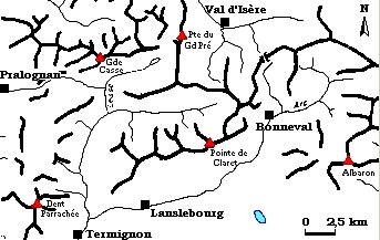
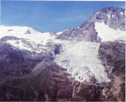
GLACIER "ROCHEMELON"
Risk type: miscellaneous
Glacier list |
Statistics
|
| Type: |
Ice cap |
| Country: |
France |
| Region: |
Savoie |
| Massif/Ice Cap: |
Mont Blanc |
| Municipality: |
|
| Municipality code: |
|
| Location: |
on the frontier between Maurienne and Italy, in the Ribon valley |
|
|
| Latitude (°, cent): |
|
|
| Longitude (°, cent): |
|
| Surface (km2): |
2,5 |
| Lenght (km): |
3 |
| Width (km): |
|
| Min. altitude (m): |
2800 |
| Max. altitude (m): |
3300 |
| Orientation (°) |
|
| Slope (°) |
9 |
|
|
EVENT: Date
//
- Date quality: |
 |
| Type: |
Glacier flood (contain both lakes and water pocket) |
 |
|
| Description |
breaking up of the morainic dam (renard, flooding). Strong hazard/risk |
|
Effects: |
strong vulnerability in the valley of Suse |
| Deaths(#) |
0 |
|
|
|
Injuried (#) |
0 |
| Note |
the quality of the information is low; the lack of details prevent to determine the phenomenon |
|
DAMAGES |
|
|
|
BIBLIOGRAPHY |
|
|
Mercalli.L, 0 - |
|
|