|
|
 GLACIORISK EUROPEAN PROJECT
|
|
France (CEMAGREF,
ETNA,
ONF-RTM,
LGGE-CNRS), Italy (CNR-IRPI,
SMS/Nimbus), Norway (UOSLO,
NVE),
Iceland (UI
(IS)), Austria (DGGS),
Switzerland (VAW-ETHZ) |
|
WELCOME TO GRIDABASE, GLACIER RISKS DATA BASE :
MAIN MENU
Gridabase
was implemented by
SMS/Nimbus
|
|
|
|
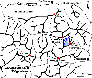
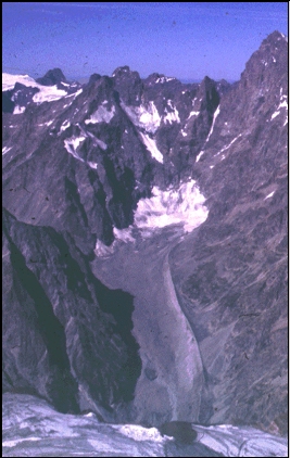
GLACIER "GLACIER NOIR"
Risk type: glacier flood (contain both lakes and water pocket)
Glacier list |
Statistics
|
| Type: |
Valley glacier |
| Country: |
France |
| Region: |
|
| Massif/Ice Cap: |
Ecrins |
| Municipality: |
|
| Municipality code: |
|
| Location: |
Glacial display well-developed overlooking the shelter Cézanne, at the place of "Pré de Mme Carle " |
|
|
| Latitude (°, cent): |
44,54 |
|
| Longitude (°, cent): |
6,23 |
| Surface (km2): |
3,5 |
| Lenght (km): |
4,8 |
| Width (km): |
0,5 |
| Min. altitude (m): |
2100 |
| Max. altitude (m): |
3150 |
| Orientation (°) |
|
| Slope (°) |
12 |
|
|
EVENT: Date
2/8/1958
- Date quality: |
 |
| Type: |
Glacier flood (contain both lakes and water pocket) |
 |
|
| Description |
a sudden and important flood from the emissary torrent of the glacier Noir occurred. During the last two weeks, there were no precipitations; and as the time of concentration of this small basin is less important than two weeks, the glacier has been implicated. Maybe the cause was a water accumulation in fissures and crevasses, but an estimation of the volume showed that it was improbable. Then there is the hypothesis of an under-glacial water pocket outburst |
|
Effects: |
grounding of the bridge which permits to go to the « glacier Blanc" and désordre notable des gabions en rive droite |
| Deaths(#) |
0 |
|
|
|
Injuried (#) |
0 |
| Note |
the information in relation with this episode is limited/reduced to an observation of the consequences, we have no estimation of the volume, flow, and last of the event |
|
DAMAGES |
|
|
|
BIBLIOGRAPHY |
|
|
Reynaud, L., 1993 - Le glacier Blanc, le glacier Noir BT Nature, pemf, 39p. |
|
|