|
|
 GLACIORISK EUROPEAN PROJECT
|
|
France (CEMAGREF,
ETNA,
ONF-RTM,
LGGE-CNRS), Italy (CNR-IRPI,
SMS/Nimbus), Norway (UOSLO,
NVE),
Iceland (UI
(IS)), Austria (DGGS),
Switzerland (VAW-ETHZ) |
|
WELCOME TO GRIDABASE, GLACIER RISKS DATA BASE :
MAIN MENU
Gridabase
was implemented by
SMS/Nimbus
|
|
|
|
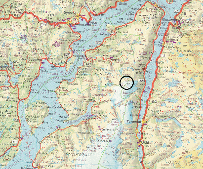
GLACIER "FOLGEFONNI, NORDRE (NV)"
Risk type: miscellaneous
Glacier list |
Statistics
|
| Type: |
Ice cap |
| Country: |
Norway |
| Region: |
Hordaland |
| Massif/Ice Cap: |
Folgefonni Nordre |
| Municipality: |
Jondal |
| Municipality code: |
|
| Location: |
Northwestern outlet from the ice cap Nordre Folgefonni, between Hardangerfjorden in west and Sørfjorden in east |
|
|
| Latitude (°, cent): |
60,221 N |
|
| Longitude (°, cent): |
6,435 E |
| Surface (km2): |
5 |
| Lenght (km): |
3,3 |
| Width (km): |
|
| Min. altitude (m): |
1200 |
| Max. altitude (m): |
1640 |
| Orientation (°) |
315 |
| Slope (°) |
|
|
|
EVENT: Date
15/10/2000
- Date quality:days |
 |
| Type: |
Accident mountaineering |
|
|
| Description |
A 28 yr-old man fell into a bergschrund at Folgefonna ski centre, no serious injury |
|
Effects: |
|
| Deaths(#) |
|
|
|
|
Injuried (#) |
1 |
| Note |
Bergens Tidende: http://www.bt.no/lokalt/article25626 |
|
DAMAGES |
|
|
|
BIBLIOGRAPHY |
|
|
|