|
|
 GLACIORISK EUROPEAN PROJECT
|
|
France (CEMAGREF,
ETNA,
ONF-RTM,
LGGE-CNRS), Italy (CNR-IRPI,
SMS/Nimbus), Norway (UOSLO,
NVE),
Iceland (UI
(IS)), Austria (DGGS),
Switzerland (VAW-ETHZ) |
|
WELCOME TO GRIDABASE, GLACIER RISKS DATA BASE :
MAIN MENU
Gridabase
was implemented by
SMS/Nimbus
|
|
|
|
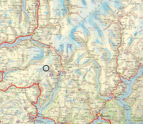
GLACIER "JOSTEFONN (S)"
Risk type: glacier flood (contain both lakes and water pocket)
Glacier list |
Statistics
|
| Type: |
Outlet glacier |
| Country: |
Norway |
| Region: |
Sogn & Fjordane |
| Massif/Ice Cap: |
Jostefonn |
| Municipality: |
Balestrand |
| Municipality code: |
|
| Location: |
15 km southwest of the southernmost part of Jostedalsbreen |
|
|
| Latitude (°, cent): |
61.418 N |
|
| Longitude (°, cent): |
6.581 E |
| Surface (km2): |
1.69 |
| Lenght (km): |
3 |
| Width (km): |
|
| Min. altitude (m): |
1060 |
| Max. altitude (m): |
1520 |
| Orientation (°) |
180 |
| Slope (°) |
|
|
|
EVENT: Date
1/1/1848
- Date quality:years |
 |
| Type: |
Glacier flood (contain both lakes and water pocket) |
|
|
| Description |
Jøkulhlaup from glacier dammed lake in Skaddalen, dammed by Vetlefjordbreen, a southern outlet from Jostefonn. Flood from glacier into Vetlefjorddalen in Balestrand, SF. |
|
Effects: |
Farms destroyed. |
| Deaths(#) |
|
|
|
|
Injuried (#) |
|
| Note |
Ref.: De Seue 1876, Liestøl 1956. Correct event date is 1848, not 01.01.1848. |
|
DAMAGES |
|
|
|
BIBLIOGRAPHY |
|
|
|
|
EVENT: Date
1/1/1820
- Date quality:years |
|
| Type: |
Glacier flood (contain both lakes and water pocket) |
|
|
| Description |
Jøkulhlaup from glacier dammed lake in Skaddalen, dammed by Vetlefjordbreen, a southern outlet from Jostefonn. Flood from glacier into Vetlefjorddalen in Balestrand, SF. |
|
Effects: |
Farms devastated |
| Deaths(#) |
|
|
|
|
Injuried (#) |
|
| Note |
Ref.: Bishop Neumann, Liestøl 1956. Event date; 1820 - not 01.01. |
|
DAMAGES |
|
|
|
BIBLIOGRAPHY |
|
|
|